
Promotional Highway Maps
- Oct 30, 2020
- 3 min read
“From Bay City, take Dixie Highway south to Corbin, then get on the Uncle Remus Route. Follow that to Dublin. Head east to the Tobacco Trail, and stay on that until you get to Tampa.”
Today these directions might seem a bit baffling, but 75 years ago they would’ve offered a sun-hungry motorist one possible route from northern Michigan to Southern Florida.
He had other choices, too. He could’ve linked up with the Ocean Highway… or cruised down the Short Highway… or dallied on the Orange Blossom Trail… or driven by way of the Seminole Trail. He might even have detoured along the Tidewater Trail or swung through the Shenandoahs on the Blue Ridge Parkway.
These highway names were chosen to lure drivers, and they were promoted by a variety of colorful brochures and strip maps, often drawn with barely a nod to geographic accuracy. Typically, they outdid each other in distorting the landscape to make their own route appear the shortest and most attractive. Usually they didn’t even show alternate routes.
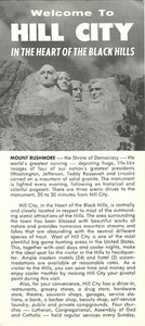
Handsome fold-out Hill City promotional brochure with road map of the Black Hills of South Dakota, printed more than 55 years ago.


The North-South roads had no monopoly on this trick. East-West competed, too. The Roosevelt Highway took on the Lincoln, and U.S. 20 vied with U.S. 80. The best-promoted of them all, U.S. 66, also known as the Will Rogers Highway, proclaimed that it was traveled by more tourists than any other east-west highway. More recent examples include the Lincoln Heritage Trail, the Hiawatha Pioneer Trail, the Dixieland Trail, the Old West trail and the Lewis & Clark Trail.
Vintage fold-out 1937 road map of the Roosevelt Highway, printed more than 80 years ago.


Handsome fold-out Hiawatha Pioneer Trail road map brochure, printed more than 50 years ago.


The maps and brochures that these various highway associations published are popular paper collectibles today and with good reason: they give a fascination picture of roadside America over the past 50-60 years, in many cases a past that is being obscured by the proliferation of fast, efficient but basically faceless interstate highways.
Official fold-out 1972 road map of Schoharie County, New York, printed more than 48 years ago.


The maps are also interesting as examples of how advertising manipulates reality. We wouldn’t expect a map put out by McDonalds to show where the Burger Kings are located, but a highway strip map that fudges on the natural landscape of the earth, alters the scale of distance and leaves off other important highways is certainly playing fast and loose with the facts. There is no crime in this, of course; to some extent all maps are selective in the detail they include. Two books, both available in paperback, that explore this subject are: How to Lie With Maps, by Mark Monmonier, University of Chicago Press, 1991 (ISBN 0-226-53415-5), and The Power of Maps, by Denis Wood, Guilford Press, 1992 (ISBN 0-89862-493-2).
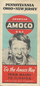
Handsome fold-out 1939 Amoco road map of Pennsylvania, Ohio, and New Jersey, with cover artwork by Norman Rockwell, printed more than 77 years ago.


Many of the various highway maps were put out by associations formed specifically to promote travel on their routes; others were issued by various state and regional chambers of commerce. A number of examples are illustrated with this article, but there are many others, some dating back to early motoring days, before the U.S. highway numbering system started to appear, and including the Blue Grass Road, the Clover Leaf Route, the Pikes Peak Ocean-Way as well as many others. I would make no claim that the examples I’ve included are even close to a complete list. I would be happy to hear from readers who have other examples. Please include the name of the highway association that published the map and the year(s) of publication, if known.
You are always welcome to contact me via our contact page.
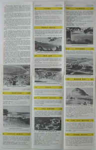
Handsome fold-out 1969 road map brochure, published by the Highway 1 Association more than 50 years ago.


Comments