
Public Transportation Maps
- Mar 20, 2021
- 3 min read
Most times, when you want to go somewhere, you hop in the car. But what if your car won’t take you where you want to go and you want to plan your trip using public transportation?
All those wonderful road maps we’ve looked at in earlier blog articles – the ones published by oil companies, state and provincial highway departments, turnpikes and toll authorities, restaurants and motels, bridge and tunnel operators and the various auto clubs – won’t be much good in helping you figure out how to get where you want to go by plane, bus or train.
Happily – and not just for the traveler planning a trip but for collectors who are fascinated by the endless variety and boundless appeal of maps in all their diversity – there are maps that are tailored to virtually any sort of travel alternative to the automobile: airline maps, bus and subway maps, railroad maps, ferry maps – maps that can be categorized generally as mass transit or public transportation maps. (For maps on walking, hiking, biking, skiing, canoeing – and other ways of getting around once you arrive at your destination – watch for future blog posts.)
As with some highway maps, many current mass transit maps can be obtained for free from the various issuing agencies by a phone call, postcard or email, allowing the collector to easily acquire new material.
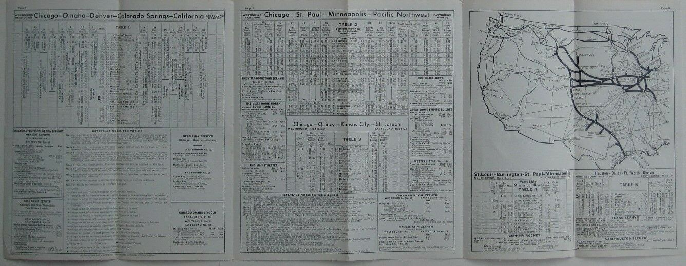
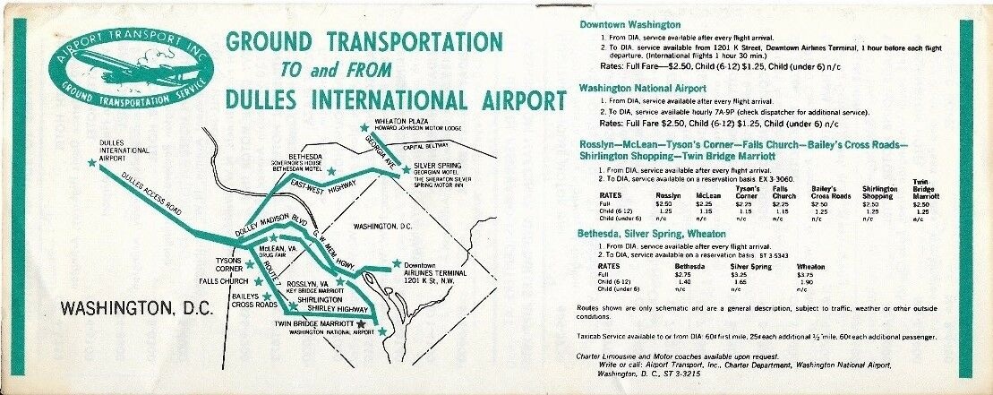
Older mass transit maps are fascinating windows to the history of transportation, showing the routes of trains and buses that have stopped running, giving timetables and schedules or depicting the areas served by smaller, regional airlines that are no longer operating. Many of the earlier railroad, bus, airplane and other mass transit maps are eagerly sought by paper and ephemera collectors who specialize in these particular areas of interest. You can them at flea markets, thrift shops, yard sales, antique shops and our very own top-rated eBay store.
A handful of older transportation maps are listed below.
Subway maps


Railroad maps


Ferry maps


Bus maps


Airplane maps


For more information on public transportation maps, as well as maps in a wide range or categories, you are welcome to contact us via our contact page.


Comments