
Oil Company Maps from Around the World
- Apr 3, 2021
- 2 min read


Old Company Maps from Around the World
Oil company road maps continue to be popular paper collectables. They sell briskly at antique malls, through advertisements in hobby publications, at map and book fairs, and on the Internet. This increased demand has not only caused prices to rise but also made these maps harder to find.
This feeding frenzy is driven by a variety of motives. Collectors often seek maps from particular brands, in some cases striving to track down every road map issued by a major oil company such as Chevron or Conoco. In other cases they look for maps from the smaller oil companies, many of which have vanished from the American roadside. Collectors also are drawn to maps that have attractive cover graphics or show old service stations. And many people want maps that show the old roads, particularly pre-Interstate Highway System maps – to retrace a route they may have taken as a kid or plan a trip they may wish to take as an adult. Others collect maps from the year they were born.
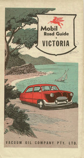
In past articles we have looked at many examples of these oil company road maps. This time, our focus will be on oil company maps for foreign destinations. Typically, these are much harder to find than the domestic issues. There were fewer issued in the first place, and they were not handed out at your neighborhood service station. But these maps are desirable not only for their scarcity but also for their colorful graphics and interesting subjects.
A 1958 ESSO map of New York or New Jersey is a nice item, it is certainly not an uncommon or hard-to-find map. But how about a 1958 ESSO map of Morocco and northern Africa? Or a 1937 MOBIL map of South Africa that locates MOBIL stations between Cape Town and Durban? Or even a 1953 SHELL map of Germany which shows the autobahns and was printed in Stuttgart?
These are some of the interesting oil company maps that are out there and would add depth and variety to your collection, if you may be able to find them. The illustrations accompanying this article are excellent examples of some of the maps known to exist.
If you have any questions, you are welcome to contact us via our contact page.
Handsome fold-out 1961 Shell road map of the city of Bergen, printed more than 60 years ago.


Left: Handsome large-format fold-out 1969 Shell road map of southwest England printed more than 51 years ago.
Right: Handsome fold-out 1967 Chevron Oil road map of Mexico, printed more than 53 years ago.


Handsome fold-out 1952 Esso road map of Germany, printed more than 68 years ago.


Large-format fold-out 1958 road map of Western Europe and adjacent North Africa, printed more than 62 years ago.


Left: Handsome fold-out 1967 Texaco road map of the province of Québec, printed more than 53 years ago.
Right: Handsome fold-out 1967 Phillips 66 road map of Mexico, printed more than 53 years ago.


Comments